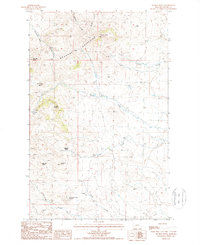
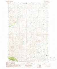
1987 Map of Suction Butte
USGS Topo · Published 1987About this map
The Bearpaw Mountains dominate this high-plains landscape, characterized by isolated buttes and seasonal watercourses. The 1987 survey reveals a terrain defined by significant elevation changes, from Suction Butte and Myrtle Butte in the north to Belcher Peak and Lookout Butte further south. The land is marked by several named basins, including Mc Donald Basin and Mc Dougal Basin, suggesting a complex system of drainage and natural catchments in this arid environment.
Find a feature on this map
18 named features on this map. Tap any name to fly to it.
Don’t see what you’re looking for? This feature index may not catch every label — zoom into the map to look around manually.
Map Details
Editions of this 1987 Suction Butte Map
This is the sole edition of this map. No revisions or reprints were ever made.
Other maps of this area

1953 · Havre
USGS Topo · 1:250,000

1956 · Rattlesnake
USGS Topo · 1:62,500

1956 · Cleveland
USGS Topo · 1:62,500

1957 · Havre
USGS Topo · 1:250,000

1958 · Havre
USGS Topo · 1:250,000

1971 · Putnam Lake
USGS Topo · 1:24,000
1971 · Lake Seventeen West
USGS Topo · 1:24,000
1971 · Newhouse Reservoir
USGS Topo · 1:24,000
1984 · Dodson
USGS Topo · 1:100,000
1987 · Cleveland
USGS Topo · 1:24,000