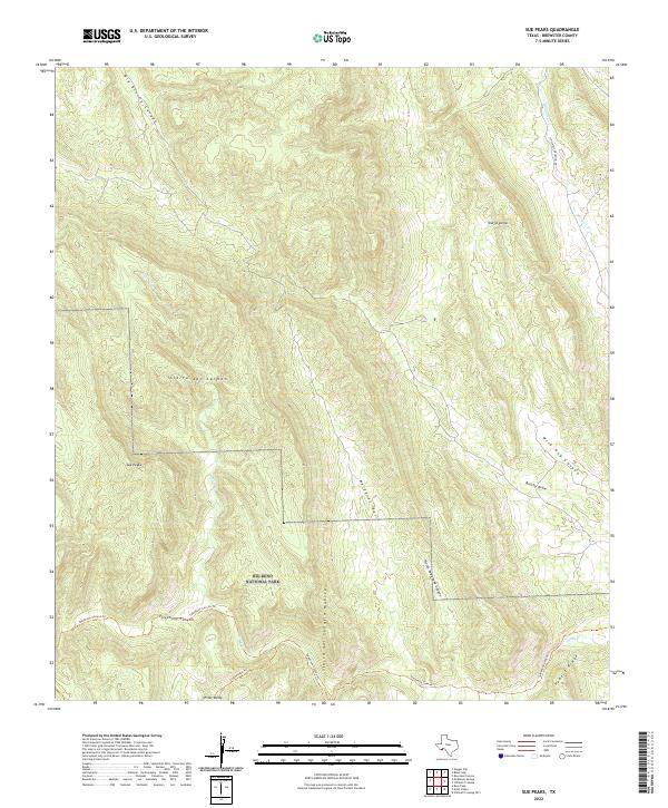
2022 Map of Sue Peaks
USGS Topo · Published 2022About this map
Big Bend National Park defines the southern portion of this high-altitude landscape, where the Sierra del Carmen and Sierra del Caballo Muerto ranges converge. This terrain is marked by steep canyons and basins, notably Wild Hog Canyon and the broad Margaret Basin. The cartography reveals a network of primitive routes and footpaths essential for navigating this arid environment, including the Telephone Canyon Trl and Strawhouse Trl.
Find a feature on this map
18 named features on this map. Tap any name to fly to it.
Don’t see what you’re looking for? This feature index may not catch every label — zoom into the map to look around manually.
Map Details
Editions of this 2022 Sue Peaks Map
This is the sole edition of this map. No revisions or reprints were ever made.
Other maps of this area

1903 · Chisos Mountains
USGS Topo · 1:125,000

1905 · Chisos Mountains
USGS Topo · 1:125,000

1917 · Bone Spring
USGS Topo · 1:62,500

1918 · Bone Spring
USGS Topo · 1:125,000

1918 · Bone Spring
USGS Topo · 1:62,500

1919 · Maravillas Canyon
USGS Topo · 1:62,500

1920 · Bone Spring
USGS Topo · 1:62,500

1930 · Stillwell Creek
USGS Topo · 1:62,500

1959 · Emory Peak
USGS Topo · 1:250,000

1965 · Emory Peak
USGS Topo · 1:250,000