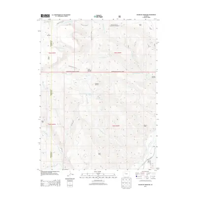
2013 Map of Sugarloaf Mountain
USGS Topo · Published 2013About this map
White River National Forest lands dominate this high-elevation landscape, where the boundary between Garfield and Eagle counties bisects a network of alpine drainage systems. The terrain transitions from the elevated plateaus of The Flat Tops and Derby Mesa in the north toward the deep incision of the Colorado River corridor in the southeast. Historical access routes such as the Ute Sweetwater Trail 2032.1 and W Mountain Trail 1817.1 underscore a long history of transhumance and timber management in the region.
Find a feature on this map
39 named features on this map. Tap any name to fly to it.
Don’t see what you’re looking for? This feature index may not catch every label — zoom into the map to look around manually.
Map Details
Editions of this 2013 Sugarloaf Mountain Map
This is the sole edition of this map. No revisions or reprints were ever made.
Other maps of this area

1927 · Glenwood Springs
USGS Topo · 1:125,000

1930 · Glenwood Springs
USGS Topo · 1:125,000

1957 · Leadville
USGS Topo · 1:250,000

1959 · Leadville
USGS Topo · 1:250,000

1960 · Leadville
USGS Topo · 1:250,000

1962 · Leadville
USGS Topo · 1:250,000

1962 · Gypsum
USGS Topo · 1:24,000

1964 · Leadville
USGS Topo · 1:250,000
1972 · Burns South
USGS Topo · 1:24,000
1972 · Burns North
USGS Topo · 1:24,000