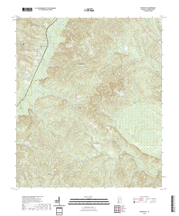
2024 Map of Suggsville
USGS Topo · Published 2024About this map
Suggsville anchors this landscape of the Alabama piney woods, a settlement deeply connected to the network of creeks and branches that drain towards the west. The terrain is defined by its watercourses, from the winding path of Bassett Creek to the smaller drainage of Barns Mill Branch, suggesting the historical importance of water-powered industry in Clarke County. Prominent landmarks such as Rock Wall Hill rise above the drainage basins, providing distinct topographical markers for local history researchers.
Find a feature on this map
32 named features on this map. Tap any name to fly to it.
Don’t see what you’re looking for? This feature index may not catch every label — zoom into the map to look around manually.
Map Details
Editions of this 2024 Suggsville Map
This is the sole edition of this map. No revisions or reprints were ever made.
Other maps of this area

1943 · Choctaw Bluff
USGS Topo · 1:62,500

1946 · Choctaw Bluff
USGS Topo · 1:62,500

1953 · Andalusia
USGS Topo · 1:250,000

1957 · Andalusia
USGS Topo · 1:250,000

1972 · Flynns Lake
USGS Topo · 1:24,000

1972 · Whatley
USGS Topo · 1:24,000

1972 · Gainestown
USGS Topo · 1:24,000

1972 · Claiborne
USGS Topo · 1:24,000

1972 · Suggsville
USGS Topo · 1:24,000

1972 · Chance
USGS Topo · 1:24,000