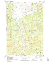
1977 Map of Sula
USGS Topo · Published 1994About this map
The Ross Hole basin serves as a central hub for this high-altitude landscape, where the East Fork Bitterroot River meets several major mountain drainages. The settlement of Sula is documented during a period of forest management and early recreation, anchored by the Sula Ranger Station and the Sula Lookout Tower atop Sula Peak. Local history and genealogy researchers will find the Sula Cem positioned just north of the town center.
Find a feature on this map
45 named features on this map. Tap any name to fly to it.
Don’t see what you’re looking for? This feature index may not catch every label — zoom into the map to look around manually.
Map Details
Editions of this 1977 Sula Map
2 editions found
Other maps of this area

1955 · Dillon
USGS Topo · 1:250,000

1956 · Elk City
USGS Topo · 1:250,000

1957 · Dillon
USGS Topo · 1:250,000

1958 · Dillon
USGS Topo · 1:250,000

1960 · Elk City
USGS Topo · 1:250,000

1960 · Piquett Mountain
USGS Topo · 1:62,500

1962 · Dillon
USGS Topo · 1:250,000
1964 · Robbins Gulch
USGS Topo · 1:24,000

1965 · Dillon
USGS Topo · 1:250,000

1965 · Medicine Hot Springs
USGS Topo · 1:24,000