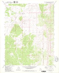
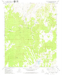
1979 Map of Sullivan Draw North
USGS Topo · Published 1979About this map
Wolf Hole Valley defines the arid, high-desert landscape of northwestern Arizona in the late 1970s. This survey by the U.S. Geological Survey emphasizes the critical role of water management in a region where natural springs are scarce. The map documents a sophisticated network of man-made and seasonal water features, including Whiterock Soapstone Reservoir, Larson Tank, and School Section Pond. These features, alongside Myron Pond and Blake Pond, illustrate the historical land use patterns common to the Arizona Strip, where ranching and livestock required widely dispersed watering holes. The terrain is marked by significant topographical shifts at Wolf Hole Pass and the drainage of Sullivan Draw, while the presence of Hobble Canyon in the southwest provides insight into the natural erosion patterns of the Mohave County desert during this era.
Find a feature on this map
14 named features on this map. Tap any name to fly to it.
Don’t see what you’re looking for? This feature index may not catch every label — zoom into the map to look around manually.
Map Details
Editions of this 1979 Sullivan Draw North Map
This is the sole edition of this map. No revisions or reprints were ever made.
Other maps of this area

1886 · Mt. Trumbull
USGS Topo · 1:250,000

1892 · Mt. Trumbull
USGS Topo · 1:250,000

1953 · Grand Canyon
USGS Topo · 1:250,000

1957 · Grand Canyon
USGS Topo · 1:250,000

1958 · Grand Canyon
USGS Topo · 1:250,000

1960 · Grand Canyon
USGS Topo · 1:250,000
1979 · Hole-N-Wall
USGS Topo · 1:24,000
1979 · Sullivan Draw South
USGS Topo · 1:24,000
1979 · St. George Canyon
USGS Topo · 1:24,000
1979 · Wolf Hole Mtn. East
USGS Topo · 1:24,000