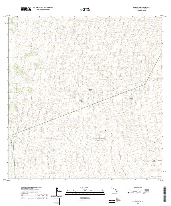
2024 Map of Sulphur Cone
USGS Topo · Published 2024About this map
Hawai‘i Volcanoes National Park and the adjacent Hawai‘i Volcanoes Wilderness dominate this high-elevation landscape on the Island of Hawai‘i. The map provides a detailed topographic record of volcanic activity, specifically delineating historical eruptions like the Lava Flow of 1851, the Lava Flow of 1949, and the Lava Flow of 1950. These flows reveal the recent geological history of the region, cutting through the terrain and defining the borders of conservation areas.
Find a feature on this map
11 named features on this map. Tap any name to fly to it.
Don’t see what you’re looking for? This feature index may not catch every label — zoom into the map to look around manually.
Map Details
Editions of this 2024 Sulphur Cone Map
This is the sole edition of this map. No revisions or reprints were ever made.
Other maps of this area

1927 · Kaohe
USGS Topo · 1:62,500

1928 · Kailua
USGS Topo · 1:62,500

1928 · Mauna Loa
USGS Topo · 1:62,500

1930 · Kaohe
USGS Topo · 1:62,500

1954 · Hawaii South
USGS Topo · 1:250,000

1954 · Hawaii North
USGS Topo · 1:250,000

1956 · Puu O Uo
USGS Topo · 1:24,000
1956 · Kokoolau
USGS Topo · 1:24,000

1959 · Hawaii South
USGS Topo · 1:250,000

1959 · Hawaii North
USGS Topo · 1:250,000