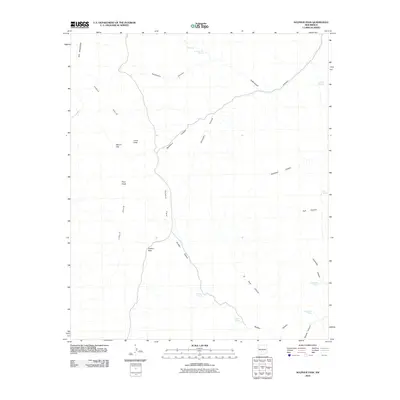
2010 Map of Sulphur Pass
USGS Topo · Published 2010About this map
Sulphur Pass serves as a central waypoint in this high-desert landscape, where the terrain is defined by a series of deep drainages and isolated water sources. The map reveals a network of canyons, including Buckhorn Canyon, Domijohn Canyon, and Cottonwood Canyon, which carve through the land towards Sulphur Flats. This area is punctuated by reliable springs such as Sulphur Spring, Crocket Spring, and Quemado Spring, which were essential for cattle ranching and travel in this arid portion of New Mexico. Notable landmarks like Pilot Knob and Loma Vista provide significant navigational points against the backdrop of the Chalk Hills and Big Mountain. The arrangement of these features suggests a landscape managed for livestock, where every named spring like HorseCamp Spring or Tub Spring represents a critical resource for local land use.
Find a feature on this map
25 named features on this map. Tap any name to fly to it.
Don’t see what you’re looking for? This feature index may not catch every label — zoom into the map to look around manually.
Map Details
Editions of this 2010 Sulphur Pass Map
This is the sole edition of this map. No revisions or reprints were ever made.
Other maps of this area

1916 · Tonuco
USGS Topo · 1:125,000

1916 · Salinas Peak
USGS Topo · 1:125,000

1932 · Tonuco
USGS Topo · 1:125,000

1948 · Sowell
USGS Topo · 1:62,500

1948 · Chicken Well
USGS Topo · 1:62,500

1948 · Kaylor Mountain
USGS Topo · 1:62,500

1948 · Black Top Mountain
USGS Topo · 1:62,500

1954 · Tularosa
USGS Topo · 1:250,000

1955 · Las Cruces
USGS Topo · 1:250,000

1958 · Las Cruces
USGS Topo · 1:250,000