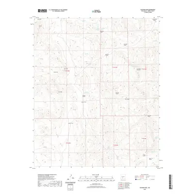
2020 Map of Sulphur Pass
USGS Topo · Published 2020About this map
The San Andres Mountains dominate this arid landscape in eastern Sierra County, where natural springs and tanks provided essential water for ranching and travel. Named water sources like Sulphur Spring, Woolf Spring, and Horse Camp Spring are scattered throughout the terrain, indicating the historical importance of localized water rights in this high-desert environment. The topography is defined by significant transitions such as Sulphur Pass and Watson Gap, which provided natural corridors through the ridges. Sulphur Flats and the elevated reach of Big Mtn characterize the area's varied elevations. While largely devoid of major settlements, the presence of the North Richard Tank and various canyons like Ash Canyon and El Paso Canyon suggest a landscape used for seasonal grazing and water management within the Public Land Survey System township divisions.
Find a feature on this map
41 named features on this map. Tap any name to fly to it.
Don’t see what you’re looking for? This feature index may not catch every label — zoom into the map to look around manually.
Map Details
Editions of this 2020 Sulphur Pass Map
This is the sole edition of this map. No revisions or reprints were ever made.
Other maps of this area

1916 · Tonuco
USGS Topo · 1:125,000

1916 · Salinas Peak
USGS Topo · 1:125,000

1932 · Tonuco
USGS Topo · 1:125,000

1948 · Sowell
USGS Topo · 1:62,500

1948 · Chicken Well
USGS Topo · 1:62,500

1948 · Kaylor Mountain
USGS Topo · 1:62,500

1948 · Black Top Mountain
USGS Topo · 1:62,500

1954 · Tularosa
USGS Topo · 1:250,000

1955 · Las Cruces
USGS Topo · 1:250,000

1958 · Las Cruces
USGS Topo · 1:250,000