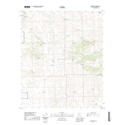
2023 Map of Sulphur Pass
USGS Topo · Published 2023About this map
The San Andres Mountains dominate this high-desert landscape in Sierra County, where the topography transitions from the dramatic peaks of Big Mountain and Pilot Knob into the broad expanse of the White Sands Missile Range. The area is defined by its seasonal water sources and deep drainage systems, including the complex networks of Domijohn Canyon and Buckhorn Canyon. These landmarks were critical waypoints for early travel through the arid Chihuahuan Desert, where the availability of Holcomb Spring, Upper Cottonwood Spring, and Horse Camp Spring dictated the movement of livestock and people. The proximity of Sulphur Pass and Sulphur Flats indicates the chemical character of the local geography, while the limited infrastructure of Co RD a021 highlights the isolation of this ranching and military corridor.
Find a feature on this map
42 named features on this map. Tap any name to fly to it.
Don’t see what you’re looking for? This feature index may not catch every label — zoom into the map to look around manually.
Map Details
Editions of this 2023 Sulphur Pass Map
This is the sole edition of this map. No revisions or reprints were ever made.
Other maps of this area

1916 · Tonuco
USGS Topo · 1:125,000

1916 · Salinas Peak
USGS Topo · 1:125,000

1932 · Tonuco
USGS Topo · 1:125,000

1948 · Sowell
USGS Topo · 1:62,500

1948 · Chicken Well
USGS Topo · 1:62,500

1948 · Kaylor Mountain
USGS Topo · 1:62,500

1948 · Black Top Mountain
USGS Topo · 1:62,500

1954 · Tularosa
USGS Topo · 1:250,000

1955 · Las Cruces
USGS Topo · 1:250,000

1958 · Las Cruces
USGS Topo · 1:250,000