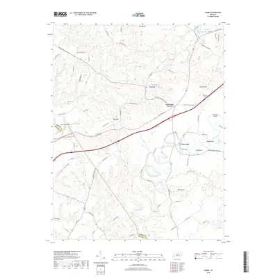
2019 Map of Summit
USGS Topo · Published 2019About this map
The Nolin River winds through the southern reaches of this Hardin County landscape, carving a deep path past Pearl Island and Sycamore Island. The settlement of White Mills sits along the river's edge, serving as a focal point for a region defined by its karst topography and agricultural hollows. To the north, the terrain rises toward The Hogback, while smaller communities like Eastview and Summit anchor the rural road network. Local history is etched into the land through family-named sites such as the Parr Hoover Cem and Duncan Cem. The presence of Saint Ignatius Spring and Wonderland Cavern Rd suggests the unique hydrogeology of the area, where underground water systems have long influenced settlement patterns and local transit routes like the Leitchfield Rd.
Find a feature on this map
76 named features on this map. Tap any name to fly to it.
Don’t see what you’re looking for? This feature index may not catch every label — zoom into the map to look around manually.
Map Details
Editions of this 2019 Summit Map
This is the sole edition of this map. No revisions or reprints were ever made.
Other maps of this area

1925 · Cub Run
USGS Topo · 1:62,500

1932 · Big Clifty
USGS Topo · 1:62,500

1934 · Munfordville
USGS Topo · 1:48,000

1935 · Elizabethtown
USGS Topo · 1:48,000

1937 · Munfordville
USGS Topo · 1:62,500

1938 · Elizabethtown
USGS Topo · 1:62,500

1948 · Cecilia
USGS Topo · 1:24,000

1949 · Sonora
USGS Topo · 1:24,000

1949 · Constantine
USGS Topo · 1:24,000

1949 · Summit
USGS Topo · 1:24,000