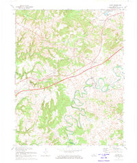
1972 Map of Summit
USGS Topo · Published 1974About this map
Stephensburg and its predecessor, Old Stephensburg, anchor the northeastern corner of this Hardin County landscape, where the karst topography of the Pennyroyal Plain meets the hilly uplands. The Nolin River winds through the southern reaches of the map, creating a series of dramatic loops and islands such as Pearl Island and Sycamore Island. This 1972 revision captures a transition in regional transportation, showing the Western Kentucky Parkway cutting diagonally across the terrain, paralleling the older corridor of the Illinois Central Railroad.
Find a feature on this map
41 named features on this map. Tap any name to fly to it.
Don’t see what you’re looking for? This feature index may not catch every label — zoom into the map to look around manually.
Map Details
Editions of this 1972 Summit Map
This is the sole edition of this map. No revisions or reprints were ever made.
Other maps of this area

1925 · Cub Run
USGS Topo · 1:62,500

1932 · Big Clifty
USGS Topo · 1:62,500

1934 · Munfordville
USGS Topo · 1:48,000

1935 · Elizabethtown
USGS Topo · 1:48,000

1937 · Munfordville
USGS Topo · 1:62,500

1938 · Elizabethtown
USGS Topo · 1:62,500

1948 · Cecilia
USGS Topo · 1:24,000

1949 · Sonora
USGS Topo · 1:24,000

1949 · Constantine
USGS Topo · 1:24,000

1949 · Summit
USGS Topo · 1:24,000