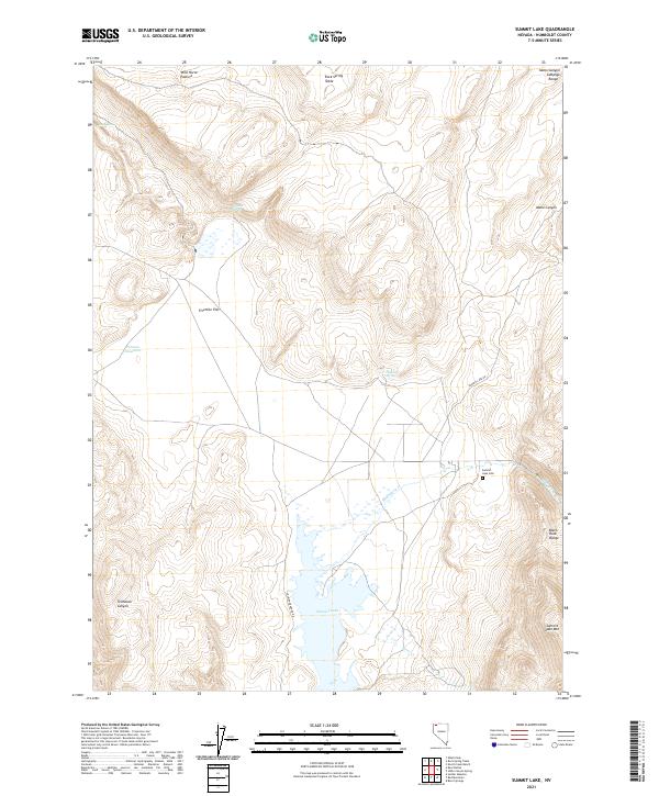
2021 Map of Summit Lake
USGS Topo · Published 2021About this map
Summit Lake dominates the southern portion of this high-desert landscape in northern Humboldt County. The surrounding terrain is defined by dramatic elevation changes, moving from the open expanse of Fivemile Flat up to the heights of Summit Lake Mtn and the Black Rock Range. Hydrology in this arid environment is centered on critical water sources like Parman Reservoir, Perry Spring, and Onemile Spring, which are essential markers for land use in the Great Basin. The presence of the Summit Lake Cem indicates the area's long-standing connection to local communities, while Summit Lake Rd and Soldier Meadows Rd provide the primary transit corridors through the complex topography of Tollhouse Canyon and across the Rock Spring Table. This survey captures the remote character of the region as it was documented in 2021.
Find a feature on this map
24 named features on this map. Tap any name to fly to it.
Don’t see what you’re looking for? This feature index may not catch every label — zoom into the map to look around manually.
Map Details
Editions of this 2021 Summit Lake Map
This is the sole edition of this map. No revisions or reprints were ever made.
Other maps of this area

1886 · Disaster
USGS Topo · 1:250,000

1889 · Long Valley
USGS Topo · 1:250,000

1893 · Disaster
USGS Topo · 1:250,000

1954 · Vya
USGS Topo · 1:250,000

1958 · Vya
USGS Topo · 1:250,000

1962 · Vya
USGS Topo · 1:250,000

1965 · Idaho Canyon
USGS Topo · 1:62,500

1965 · Rock Spring Table
USGS Topo · 1:62,500

1972 · Soldier Meadow
USGS Topo · 1:24,000

1972 · Burnt Springs
USGS Topo · 1:24,000