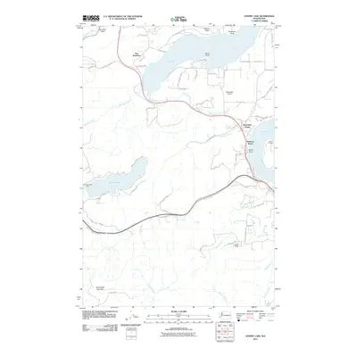
2011 Map of Summit Lake
USGS Topo · Published 2011About this map
Oyster Bay and Totten Inlet define the intricate shoreline of the southern Salish Sea, where the maritime character of Mason and Thurston counties is on full display. This 2011 survey illustrates the residential clusters of New Kamilche and Madrona Beach along the waterfront, while further inland, the landscape rises toward the peaks of the Capitol Forest. The prominent Rock Candy Mountain anchors the southern terrain, overlooking the headwaters of Waddell Creek and McLane Creek. A clear division exists between the developed bayside communities like Schneiders Prairie and the more secluded highland areas surrounding Summit Lake. This water body is managed by the Summit Lake Dam, which regulates the flow into the Kennedy Creek drainage system, a vital hydrological feature of the region's densely forested environment.
Find a feature on this map
65 named features on this map. Tap any name to fly to it.
Don’t see what you’re looking for? This feature index may not catch every label — zoom into the map to look around manually.
Map Details
Editions of this 2011 Summit Lake Map
This is the sole edition of this map. No revisions or reprints were ever made.
Other maps of this area

1916 · Chehalis
USGS Topo · 1:125,000

1937 · Olympia
USGS Topo · 1:62,500

1939 · Shelton
USGS Topo · 1:62,500

1940 · Tenino
USGS Topo · 1:62,500

1941 · Gate
USGS Topo · 1:62,500

1944 · Tenino
USGS Topo · 1:62,500

1949 · Tenino
USGS Topo · 1:62,500

1949 · Olympia
USGS Topo · 1:62,500

1953 · Hoquiam
USGS Topo · 1:250,000

1953 · Rochester
USGS Topo · 1:62,500