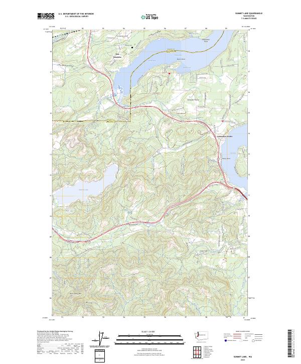
2023 Map of Summit Lake
USGS Topo · Published 2023About this map
Totten Inlet and Eld Inlet carve deeply into the landscape at the southern end of the Salish Sea, framing the complex coastal geography of the Mason Co and Thurston Co border. The settlement of New Kamilche sits near the head of Oyster Bay, while the Squaxin Cem indicates the long-standing indigenous presence in the Kamilche Valley. This area shows a transition from the marine-oriented shoreline communities to the heavily forested uplands of the Capitol Forest to the south.
Find a feature on this map
91 named features on this map. Tap any name to fly to it.
Don’t see what you’re looking for? This feature index may not catch every label — zoom into the map to look around manually.
Map Details
Editions of this 2023 Summit Lake Map
This is the sole edition of this map. No revisions or reprints were ever made.
Other maps of this area

1916 · Chehalis
USGS Topo · 1:125,000

1937 · Olympia
USGS Topo · 1:62,500

1939 · Shelton
USGS Topo · 1:62,500

1940 · Tenino
USGS Topo · 1:62,500

1941 · Gate
USGS Topo · 1:62,500

1944 · Tenino
USGS Topo · 1:62,500

1949 · Tenino
USGS Topo · 1:62,500

1949 · Olympia
USGS Topo · 1:62,500

1953 · Hoquiam
USGS Topo · 1:250,000

1953 · Rochester
USGS Topo · 1:62,500