
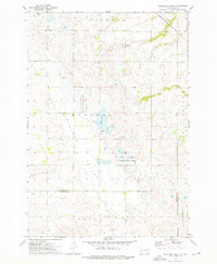
1970 Map of Summit
USGS Topo · Published 1973About this map
The town of Summit serves as the focal point of this 1970 prairie survey, situated where the Chicago Milwaukee St Paul and Pacific railroad grade intersects the Coteau des Prairies. This landscape is a complex patchwork of glacial potholes and wetlands, including Mollie Lake and the headwaters of the Big Sioux River. The map meticulously records the intersection of human and natural boundaries, from the Sisseton Indian Reservation Boundary and township lines like Farmington and Ortley to the protected wetlands of the National Wildlife Management Area. For genealogists and local historians, the sheet provides detailed locations for the Summit Cem and outlying farmstead infrastructure, including numerous gravel pits and wells. The wide expanse of Blooming Valley in the southwest contrasts with the lake-dotted terrain of the Osceola and Summit districts, showing the region just as modern highway development was under construction.
Find a feature on this map
21 named features on this map. Tap any name to fly to it.
Don’t see what you’re looking for? This feature index may not catch every label — zoom into the map to look around manually.
Map Details
Editions of this 1970 Summit Map
This is the sole edition of this map. No revisions or reprints were ever made.
Other maps of this area

1953 · Milbank
USGS Topo · 1:250,000

1958 · Milbank
USGS Topo · 1:250,000

1970 · Lonesome Lake
USGS Topo · 1:24,000

1970 · Summit NE
USGS Topo · 1:24,000

1970 · Marvin
USGS Topo · 1:24,000

1970 · Wilmot NW
USGS Topo · 1:24,000

1970 · Enemy Swim Lake East
USGS Topo · 1:24,000

1970 · Ortley
USGS Topo · 1:24,000

1970 · Still Lake NE
USGS Topo · 1:24,000
1973 · Antelope Valley
USGS Topo · 1:24,000