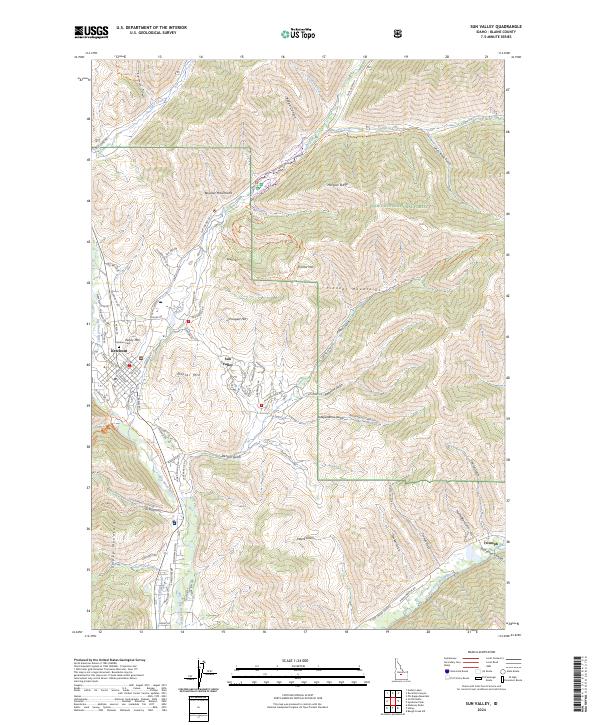
2024 Map of Sun Valley
USGS Topo · Published 2024About this map
Ketchum sits at the convergence of three mountain ranges, serving as a gateway to the Sawtooth National Forest in this 2024 survey of the central Idaho highlands. The geography is defined by the meeting of the Boulder Mountains, the Pioneer Mountains, and the Smoky Mountains, with the Big Wood River and Trail Creek carving through the valley floor. The map highlights the extensive modern recreation infrastructure, tracing specialized routes like the Boundary Loop Ski Trail and Proctor Loop Ski Trail that wind around prominent peaks such as Penny Mtn and Ruud Mtn.
Find a feature on this map
99 named features on this map. Tap any name to fly to it.
Don’t see what you’re looking for? This feature index may not catch every label — zoom into the map to look around manually.
Map Details
Editions of this 2024 Sun Valley Map
This is the sole edition of this map. No revisions or reprints were ever made.
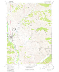
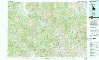
Historical Maps of Ketchum Through Time
3 maps found