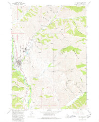
1967 Map of Sun Valley
USGS Topo · Published 1980About this map
Sun Valley and Ketchum appear at a pivotal moment of mid-century development in the late 1960s, framed by the rugged drainage of the Big Wood River and the high ridges of the Sawtooth National Forest. The map documents a fascinating transition between the region's industrial past and its growing resort identity. Extensive mining history is visible to the east, where the Triumph Mine, North Star Mine, and Independence Mine dot the gulches, complete with a Tailings Pond near the settlement of Triumph.
Find a feature on this map
59 named features on this map. Tap any name to fly to it.
Don’t see what you’re looking for? This feature index may not catch every label — zoom into the map to look around manually.
Map Details
Editions of this 1967 Sun Valley Map
Other maps of this area

1895 · Hailey
USGS Topo · 1:125,000

1897 · Hailey
USGS Topo · 1:125,000

1955 · Hailey
USGS Topo · 1:250,000

1959 · Hailey
USGS Topo · 1:250,000

1962 · Hailey
USGS Topo · 1:250,000

1967 · Rock Roll Canyon
USGS Topo · 1:24,000

1967 · Baugh Creek SW
USGS Topo · 1:24,000

1967 · Mahoney Butte
USGS Topo · 1:24,000

1967 · Sun Valley
USGS Topo · 1:24,000

1967 · Hailey
USGS Topo · 1:24,000