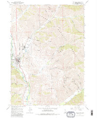
1967 Map of Sun Valley
USGS Topo · Published 1980About this map
The silver and lead mining heritage of the Sawtooth National Forest is on full display in this mid-century record of the Wood River Valley. While Sun Valley and Ketchum are established as growing recreation hubs, the eastern ridges are dominated by an extensive network of mining operations. Significant sites include the Triumph Mine, North Star Mine, and the Independence Mine, alongside specialized infrastructure like the Pierce Tunnel and Tailings Pond. This landscape illustrates the transition of the region, where industrial extraction once sat directly adjacent to early ski developments on Ruud Mountain and Dollar Mountain. The Union Pacific railroad corridor follows the Big Wood River, providing the vital transportation link that historically served both the valley's ore exports and its emerging tourism industry.
Find a feature on this map
55 named features on this map. Tap any name to fly to it.
Don’t see what you’re looking for? This feature index may not catch every label — zoom into the map to look around manually.
Map Details
Editions of this 1967 Sun Valley Map
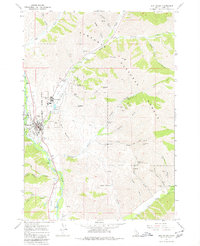
Other maps of this area

1895 · Hailey
USGS Topo · 1:125,000

1897 · Hailey
USGS Topo · 1:125,000

1955 · Hailey
USGS Topo · 1:250,000

1959 · Hailey
USGS Topo · 1:250,000

1962 · Hailey
USGS Topo · 1:250,000

1967 · Rock Roll Canyon
USGS Topo · 1:24,000

1967 · Baugh Creek SW
USGS Topo · 1:24,000

1967 · Mahoney Butte
USGS Topo · 1:24,000

1967 · Sun Valley
USGS Topo · 1:24,000

1967 · Hailey
USGS Topo · 1:24,000