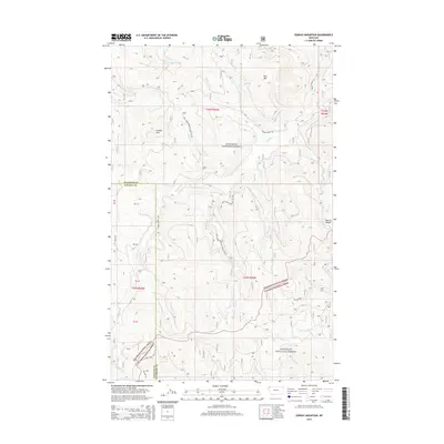
2014 Map of Sunday Mountain
USGS Topo · Published 2014About this map
Kootenai National Forest and Flathead National Forest converge in this high-elevation corner of Northwest Montana. The landscape is dominated by the massive profile of Sunday Mtn and the neighboring Paul Mtn, which serve as the primary topographic anchors for the surrounding drainage basins. A complex network of timber and access routes, including the Sunday Creek Rd and several National Forest Development roads like Natl Forest Develop Road 3711 Rd, illustrates the intersection of recreation and forest management in this timber-rich region.
Find a feature on this map
28 named features on this map. Tap any name to fly to it.
Don’t see what you’re looking for? This feature index may not catch every label — zoom into the map to look around manually.
Map Details
Editions of this 2014 Sunday Mountain Map
This is the sole edition of this map. No revisions or reprints were ever made.
Other maps of this area

1913 · Stryker
USGS Topo · 1:125,000

1916 · Stryker
USGS Topo · 1:125,000

1957 · Kalispell
USGS Topo · 1:250,000

1960 · Kalispell
USGS Topo · 1:250,000

1961 · Kalispell
USGS Topo · 1:250,000

1962 · Johnson Peak
USGS Topo · 1:24,000

1963 · Stryker
USGS Topo · 1:24,000
1963 · Skillet Mountain
USGS Topo · 1:24,000

1963 · Sunday Mountain
USGS Topo · 1:24,000
1963 · Edna Mountain
USGS Topo · 1:24,000