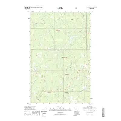
2020 Map of Sunday Mountain
USGS Topo · Published 2020About this map
The Lincoln and Flathead county line cuts through this high-country landscape, where the Kootenai National Forest meets the Flathead National Forest. This 2020 map documents a terrain defined by ridges and drainage basins, most notably the towering Sunday Mtn and Paul Mtn. The watershed is carved by numerous seasonal and perennial flows, including Sunday Creek and its East Fork, alongside smaller runs like Magnesia Creek and Stewart Creek.
Find a feature on this map
46 named features on this map. Tap any name to fly to it.
Don’t see what you’re looking for? This feature index may not catch every label — zoom into the map to look around manually.
Map Details
Editions of this 2020 Sunday Mountain Map
This is the sole edition of this map. No revisions or reprints were ever made.
Other maps of this area

1913 · Stryker
USGS Topo · 1:125,000

1916 · Stryker
USGS Topo · 1:125,000

1957 · Kalispell
USGS Topo · 1:250,000

1960 · Kalispell
USGS Topo · 1:250,000

1961 · Kalispell
USGS Topo · 1:250,000

1962 · Johnson Peak
USGS Topo · 1:24,000

1963 · Stryker
USGS Topo · 1:24,000
1963 · Skillet Mountain
USGS Topo · 1:24,000

1963 · Sunday Mountain
USGS Topo · 1:24,000
1963 · Edna Mountain
USGS Topo · 1:24,000