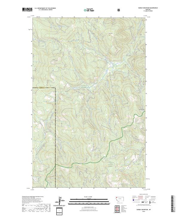
2024 Map of Sunday Mountain
USGS Topo · Published 2024About this map
Kootenai National Forest and Flathead National Forest dominate this landscape, meeting along the western border where Lincoln and Flathead Counties converge. The terrain is defined by prominent peaks including Sunday Mtn and Paul Mtn, which serve as the headwaters for a dense network of mountain streams. High-altitude drainage systems like Magnesia Creek in the north and the East Fork Sunday Creek in the south carve through the timbered slopes. Evidence of forest management and access is visible through a complex grid of interior logging and development routes, such as Natl Forest Develop Road 3710 Rd and Alder Creek Rd. Along the eastern edge, the Martin Divide forms a significant topographical boundary, separating the western drainages from the Martin Creek basin, illustrating the complex watershed divide that characterizes this part of the northern Rockies.
Find a feature on this map
44 named features on this map. Tap any name to fly to it.
Don’t see what you’re looking for? This feature index may not catch every label — zoom into the map to look around manually.
Map Details
Editions of this 2024 Sunday Mountain Map
This is the sole edition of this map. No revisions or reprints were ever made.
Other maps of this area

1913 · Stryker
USGS Topo · 1:125,000

1916 · Stryker
USGS Topo · 1:125,000

1957 · Kalispell
USGS Topo · 1:250,000

1960 · Kalispell
USGS Topo · 1:250,000

1961 · Kalispell
USGS Topo · 1:250,000

1962 · Johnson Peak
USGS Topo · 1:24,000

1963 · Stryker
USGS Topo · 1:24,000
1963 · Skillet Mountain
USGS Topo · 1:24,000

1963 · Sunday Mountain
USGS Topo · 1:24,000
1963 · Edna Mountain
USGS Topo · 1:24,000