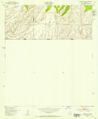
1948 Map of Sunnyside SW
USGS Topo · Published 1953About this map
The high desert borderlands of Cochise County are documented here during the late 1940s, highlighting the rugged livestock operations and topographic isolation along the international boundary. Remote homesteads such as McNab Ranch and Lone Mountain Ranch sit at the southern edge of the Coronado National Forest, where steep drainage systems like Sunnyside Canyon and Bodie Canyon define the landscape. This 1948 survey is particularly significant for its precise marking of the United States-Mexico border, including survey markers like Mon 106 5211 along the line between Arizona and Sonora. The terrain transitions from the heights of Campini Mesa to the drainage of Joaquin Creek, revealing a landscape where water sources were critical, evidenced by the presence of a lone Windmill amidst the complex elevation contours of the Huachuca Peak vicinity.
Find a feature on this map
14 named features on this map. Tap any name to fly to it.
Don’t see what you’re looking for? This feature index may not catch every label — zoom into the map to look around manually.
Map Details
Editions of this 1948 Sunnyside SW Map
This is the sole edition of this map. No revisions or reprints were ever made.
Other maps of this area

1905 · Nogales
USGS Topo · 1:125,000

1914 · Hereford
USGS Topo · 1:125,000

1922 · Sunnyside
USGS Topo · 1:62,500

1932 · Lochiel
USGS Topo · 1:62,500

1938 · Sunnyside
USGS Topo · 1:62,500

1948 · Canelo Pass
USGS Topo · 1:24,000

1948 · Huachuca Peak
USGS Topo · 1:24,000

1948 · Miller Peak
USGS Topo · 1:24,000

1948 · Sunnyside SE
USGS Topo · 1:24,000
1948 · Lochiel SE
USGS Topo · 1:24,000