Loading...
Loading map...2023 Map of Sunrise Beach
USGS Topo · Published 2023About this map
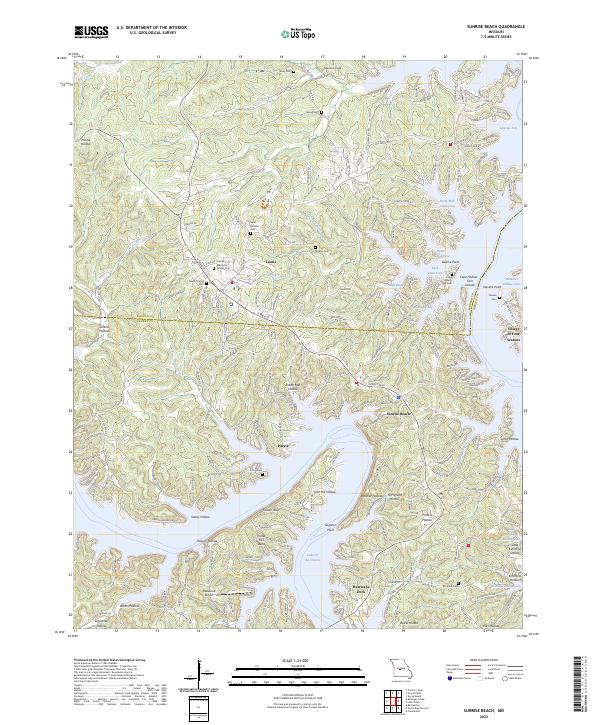
The complex shoreline of the Lake of the Ozarks dominates this modern Missouri landscape, where the Morgan Co and Camden Co line crosses the water. Residential development is clustered around the Gravois Arm and various coves, including Still Water Bay and Moonlight Bay. The map records a dense network of local history sites, from the Ozark Chapel in the west to several family-named burial grounds like Purvis Cem and Stevens Cem.
Find a feature on this map
58 named features on this map. Tap any name to fly to it.
Don’t see what you’re looking for? This feature index may not catch every label — zoom into the map to look around manually.
Map Details
Date Portrayed2023
Date Published2023
PublisherU.S. Geological Survey
Map TypeTopographic
Scale1:24000
Physical Dimensions24 x 29 inches
Editions of this 2023 Sunrise Beach Map
This is the sole edition of this map. No revisions or reprints were ever made.
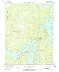
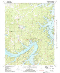
Historical Maps of Purvis Through Time
3 maps found
Featured Locations
Source Details
SourceU.S. Geological Survey
CopyrightPublic Domain