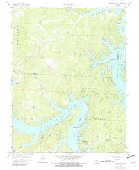
1959 Map of Sunrise Beach
USGS Topo · Published 1982About this map
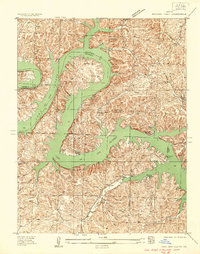
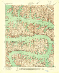
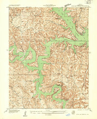
Lake of the Ozarks dominates this central Missouri landscape, where the inundated valley of the Osage River creates a complex network of points, coves, and deep hollows. The settlement at Sunrise Beach serves as a focal point for the growing recreational and residential development along the shoreline, while the inland areas maintain a traditional rural character. Notable landmarks include the Hurricane Deck Lookout Tower and the historic St Patricks Ch, reflecting the early spiritual and civic life of Morgan and Camden counties.
Find a feature on this map
46 named features on this map. Tap any name to fly to it.
Don’t see what you’re looking for? This feature index may not catch every label — zoom into the map to look around manually.
Map Details
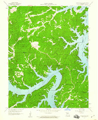
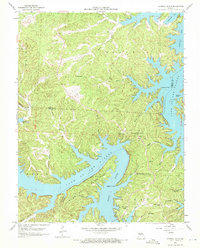
Editions of this 1959 Sunrise Beach Map
3 editions found
Other maps of this area

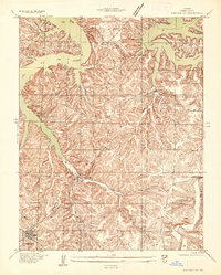
1888 · Versailles
USGS Topo · 1:125,000

1893 · Versailles
USGS Topo · 1:125,000

1904 · Eldon
USGS Topo · 1:62,500

1904 · Gravois Mills
USGS Topo · 1:62,500

1932 · Versailles No 4
USGS Topo · 1:48,000
1934 · Camdenton
USGS Topo · 1:24,000

1934 · Purvis
USGS Topo · 1:24,000
1934 · Irontown Ferry
USGS Topo · 1:24,000
1934 · Lake Ozark
USGS Topo · 1:24,000
1934 · Green Bay Terrace
USGS Topo · 1:24,000