
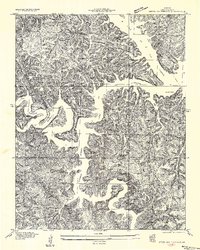
1934 Map of Green Bay Terrace
USGS Topo · Published 1934About this map
Lake of the Ozarks dominates this 1934 topographic survey, revealing the intricate shoreline of the Niangua Branch and Little Niangua Branch shortly after the reservoir's creation. The landscape is a labyrinth of steep hollows and ridges, such as Linn Creek Road Ridge and Standing Rock Ridge, where small pockets of settlement like the Niangua Colony and Climax persisted in the rugged Camden County interior.
Find a feature on this map
45 named features on this map. Tap any name to fly to it.
Don’t see what you’re looking for? This feature index may not catch every label — zoom into the map to look around manually.
Map Details
Editions of this 1934 Green Bay Terrace Map
2 editions found
Other maps of this area

1888 · Versailles
USGS Topo · 1:125,000

1893 · Versailles
USGS Topo · 1:125,000

1932 · Versailles No 4
USGS Topo · 1:48,000

1933 · Stoutland
USGS Topo · 1:62,500

1934 · Macks Creek
USGS Topo · 1:48,000

1934 · Camdenton
USGS Topo · 1:24,000

1934 · Purvis
USGS Topo · 1:24,000

1934 · Irontown Ferry
USGS Topo · 1:24,000

1934 · Lake Ozark
USGS Topo · 1:24,000

1935 · Barnumton
USGS Topo · 1:24,000