
1936 Map of Sunrise
USGS Topo · Published 1936About this map
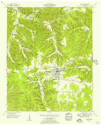
Swan Creek carves a winding path through this portion of Middle Tennessee, defining a landscape of narrow hollows and high ridges during the mid-1930s. The region is marked by small, scattered settlements like Sunrise and Bond Switch, which are connected by a network of rural roads and the Nashville Chattanooga and St Louis Ry running through the western corridor. The Tennessee Valley Authority, with Arthur E. Morgan as chief engineer, documented this area as rural electrification began to reach the interior, noted here by the Tennessee Electric Power Company Transmission Line. Genealogists will find significant value in the documentation of local community hubs, including Raleigh Chapel, Campground Ch, and several family burial grounds such as Whiteside Cem and Watson Cem. Numerous named hollows, from Stillhouse Hollow to Sugarcamp Hollow, reflect the traditional land use and geography of Hickman and Lewis counties.
Find a feature on this map
83 named features on this map. Tap any name to fly to it.
Don’t see what you’re looking for? This feature index may not catch every label — zoom into the map to look around manually.
Map Details
Editions of this 1936 Sunrise Map
This is the sole edition of this map. No revisions or reprints were ever made.
Other maps of this area

1901 · Colombia
USGS Topo · 1:125,000

1936 · Mt Joy
USGS Topo · 1:24,000

1936 · Beaverdam Springs
USGS Topo · 1:24,000

1936 · Nunnelly
USGS Topo · 1:24,000

1936 · Whitfield
USGS Topo · 1:24,000

1936 · Littlelot
USGS Topo · 1:24,000

1936 · Greenfield Bend
USGS Topo · 1:24,000

1936 · Kimmins
USGS Topo · 1:24,000

1936 · Gordonsburg
USGS Topo · 1:24,000
1951 · Kimmins
USGS Topo · 1:24,000