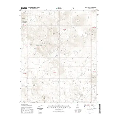
2014 Map of Sunset Crater East
USGS Topo · Published 2014About this map
Sunset Crater and its volcanic neighbors dominate this high-desert landscape within the Coconino National Forest. The 2014 terrain is defined by a dense concentration of cinder cones and geological basins, including Double Crater, Moon Crater, and Pinnacle Crater. To the southwest, the residential community of Doney Park sits on the edge of the volcanic field, showing a modern settlement pattern built around the complex topography. The map details a network of drainage features like Kanaa Wash and San Francisco Wash, along with water catchment points such as Turkey Tanks and several instances of Trick Tank. These features highlight the importance of water management in an area shaped by porous volcanic soils and high-elevation aridity.
Find a feature on this map
31 named features on this map. Tap any name to fly to it.
Don’t see what you’re looking for? This feature index may not catch every label — zoom into the map to look around manually.
Map Details
Editions of this 2014 Sunset Crater East Map
This is the sole edition of this map. No revisions or reprints were ever made.
Other maps of this area

1886 · San Francisco Mtns
USGS Topo · 1:250,000

1891 · San Francisco Mtns
USGS Topo · 1:250,000

1894 · San Francisco Mtns
USGS Topo · 1:250,000

1899 · San Francisco Mtns
USGS Topo · 1:250,000

1908 · Flagstaff
USGS Topo · 1:125,000

1912 · Flagstaff
USGS Topo · 1:125,000

1947 · Flagstaff
USGS Topo · 1:250,000

1954 · Flagstaff
USGS Topo · 1:250,000

1958 · Flagstaff
USGS Topo · 1:250,000

1960 · Flagstaff
USGS Topo · 1:250,000