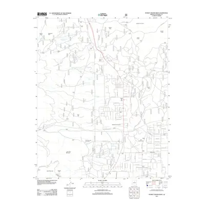
2011 Map of Sunset Crater West
USGS Topo · Published 2011About this map
The cinder-cone landscape and volcanic fields of Coconino County are documented here during a period of residential expansion. The settlement of Doney Park sits east of Little Elden Mountain and Old Caves Crater, where a dense network of suburban roads like Peaks Pkwy and E Sunset Blvd contrasts with the surrounding volcanic terrain. To the north, the massive Bonito Lava Flow and the iconic Sunset Crater define the geological character of the region, flanked by Lenox Crater and the ephemeral Cinder Lake.
Find a feature on this map
87 named features on this map. Tap any name to fly to it.
Don’t see what you’re looking for? This feature index may not catch every label — zoom into the map to look around manually.
Map Details
Editions of this 2011 Sunset Crater West Map
This is the sole edition of this map. No revisions or reprints were ever made.
Other maps of this area

1886 · San Francisco Mtns
USGS Topo · 1:250,000

1891 · San Francisco Mtns
USGS Topo · 1:250,000

1894 · San Francisco Mtns
USGS Topo · 1:250,000

1899 · San Francisco Mtns
USGS Topo · 1:250,000

1908 · Flagstaff
USGS Topo · 1:125,000

1912 · Flagstaff
USGS Topo · 1:125,000

1947 · Flagstaff
USGS Topo · 1:250,000

1954 · Flagstaff
USGS Topo · 1:250,000

1958 · Flagstaff
USGS Topo · 1:250,000

1960 · Flagstaff
USGS Topo · 1:250,000