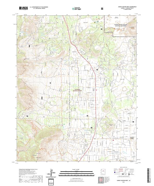
2021 Map of Sunset Crater West
USGS Topo · Published 2021About this map
Sunset Crater Volcano National Monument and its surrounding volcanic landscape define this portion of the Coconino National Forest. The map documents a striking geology where the Bonita Lava Flow meets the Cinder Hills, punctuated by prominent peaks like Sunset Crater and Lenox Crater. Human presence is concentrated in residential pockets such as Lenox Park and Doney Park, while the high country features essential water sources for this arid environment, including Lockett Meadow Spring and Eighty-nine Tank. A sophisticated network of backcountry routes, such as the Arizona National Scenic Trl and Waterline Trl, provides access through Weatherford Canyon and the Interior Valley of San Francisco Mtn. This record illustrates the modern intersection of protected geological wonders and residential expansion on the fringes of the mountains.
Find a feature on this map
112 named features on this map. Tap any name to fly to it.
Don’t see what you’re looking for? This feature index may not catch every label — zoom into the map to look around manually.
Map Details
Editions of this 2021 Sunset Crater West Map
This is the sole edition of this map. No revisions or reprints were ever made.
Other maps of this area

1886 · San Francisco Mtns
USGS Topo · 1:250,000

1891 · San Francisco Mtns
USGS Topo · 1:250,000

1894 · San Francisco Mtns
USGS Topo · 1:250,000

1899 · San Francisco Mtns
USGS Topo · 1:250,000

1908 · Flagstaff
USGS Topo · 1:125,000

1912 · Flagstaff
USGS Topo · 1:125,000

1947 · Flagstaff
USGS Topo · 1:250,000

1954 · Flagstaff
USGS Topo · 1:250,000

1958 · Flagstaff
USGS Topo · 1:250,000

1960 · Flagstaff
USGS Topo · 1:250,000