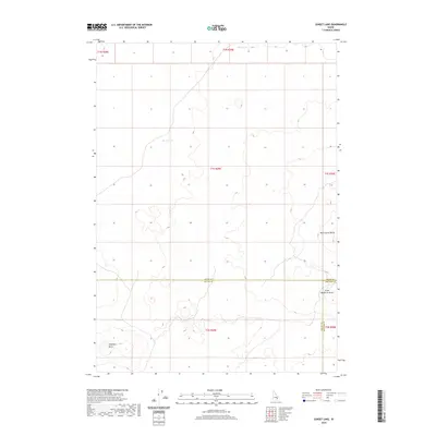
2020 Map of Sunset Lake
USGS Topo · Published 2020About this map
Sunset Lake and Rocky Lake anchor this high desert landscape within the Snake River Plain, where the borders of Butte, Bingham, and Blaine counties meet. The topography is defined by volcanic features, including the prominent Rock Corral Butte and Little Wildhorse Butte in the eastern and central reaches. This area is characterized by vast sections of public lands, as evidenced by the systematic grid of township and range lines such as t1s r29e. To the southwest, Antelope Butte rises above the surrounding terrain, providing a significant landmark for navigating this largely uninhabited portion of the Idaho interior. The map illustrates a landscape shaped by geological forces rather than dense human settlement, focusing on natural hydrology and distinctive topographical rises.
Find a feature on this map
14 named features on this map. Tap any name to fly to it.
Don’t see what you’re looking for? This feature index may not catch every label — zoom into the map to look around manually.
Map Details
Editions of this 2020 Sunset Lake Map
This is the sole edition of this map. No revisions or reprints were ever made.
Other maps of this area

1955 · Idaho Falls
USGS Topo · 1:250,000

1958 · Idaho Falls
USGS Topo · 1:250,000

1972 · Quaking Aspen Butte
USGS Topo · 1:24,000

1972 · Antelope Lake
USGS Topo · 1:24,000

1972 · Split Top
USGS Topo · 1:24,000

1972 · Big Southern Butte
USGS Topo · 1:24,000

1972 · Sunset Lake
USGS Topo · 1:24,000

1972 · Serviceberry Butte
USGS Topo · 1:24,000

1973 · Scoville
USGS Topo · 1:24,000

1973 · Rock Butte
USGS Topo · 1:24,000