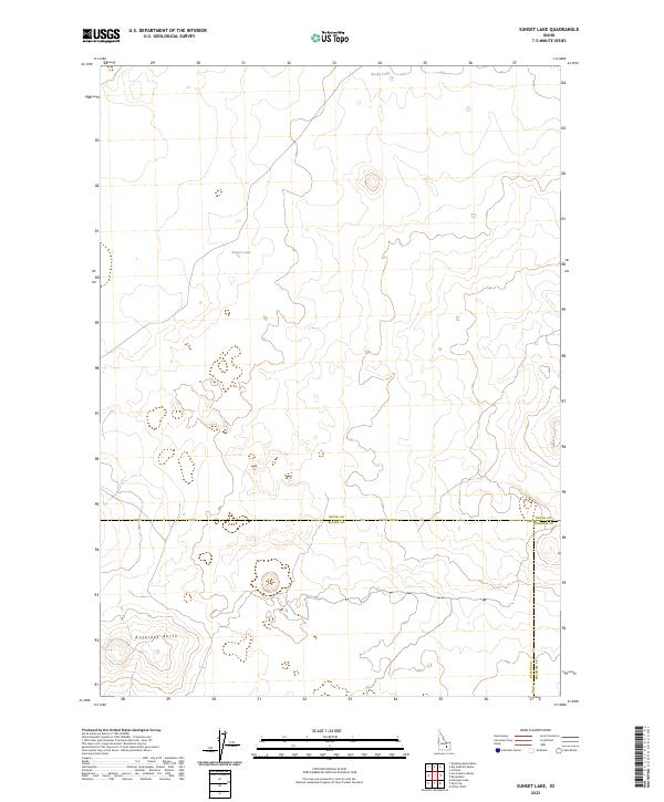
2023 Map of Sunset Lake
USGS Topo · Published 2023About this map
Antelope Butte rises as a prominent landmark in this high-elevation landscape where the boundaries of Butte, Blaine, and Bingham counties converge. This 2023 survey by the U.S. Geological Survey depicts a largely undeveloped region characterized by interior drainage, where ephemeral water bodies like Sunset Lake and Rocky Lake are the primary named features. The map illustrates a strictly surveyed grid of the Public Land Survey System across the high desert terrain, providing a contemporary view of the region before any major modern shifts in land use or infrastructure. The convergence of three county lines—Butte, Blaine, and Bingham—makes this a unique reference for understanding modern administrative divisions in this part of Idaho.
Find a feature on this map
6 named features on this map. Tap any name to fly to it.
Don’t see what you’re looking for? This feature index may not catch every label — zoom into the map to look around manually.
Map Details
Editions of this 2023 Sunset Lake Map
This is the sole edition of this map. No revisions or reprints were ever made.
Other maps of this area

1955 · Idaho Falls
USGS Topo · 1:250,000

1958 · Idaho Falls
USGS Topo · 1:250,000

1972 · Quaking Aspen Butte
USGS Topo · 1:24,000

1972 · Antelope Lake
USGS Topo · 1:24,000

1972 · Split Top
USGS Topo · 1:24,000

1972 · Big Southern Butte
USGS Topo · 1:24,000

1972 · Sunset Lake
USGS Topo · 1:24,000

1972 · Serviceberry Butte
USGS Topo · 1:24,000

1973 · Scoville
USGS Topo · 1:24,000

1973 · Rock Butte
USGS Topo · 1:24,000