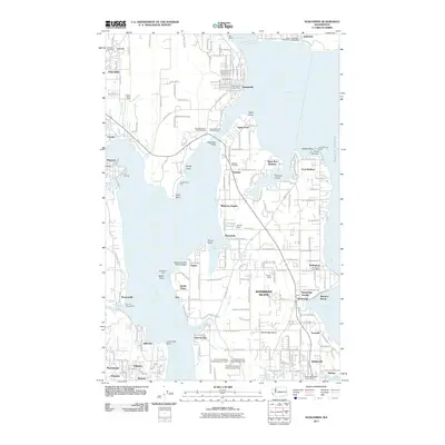
2011 Map of Suquamish
USGS Topo · Published 2011About this map
Bainbridge Island and the adjacent Kitsap Peninsula shoreline are defined by a complex network of waterways, including Port Madison, Liberty Bay, and Agate Passage. The landscape is a patchwork of small communities such as Suquamish, Indianola, and Port Madison, connected by the prominent Agate Pass Bridge. Local infrastructure is highly visible, from the Agate Pass Park and Ride East to numerous small-scale water management features like the Erickson Reservoir Dam, Koura Dam, and the series of C and H Johnson dams.
Find a feature on this map
183 named features on this map. Tap any name to fly to it.
Don’t see what you’re looking for? This feature index may not catch every label — zoom into the map to look around manually.
Map Details
Editions of this 2011 Suquamish Map
This is the sole edition of this map. No revisions or reprints were ever made.
Other maps of this area

1894 · Seattle
USGS Topo · 1:62,500

1895 · Snohomish
USGS Topo · 1:125,000

1897 · Seattle
USGS Topo · 1:125,000

1908 · Seattle
USGS Topo · 1:62,500

1909 · Seattle Special
USGS Topo · 1:62,500

1937 · Port Orchard
USGS Topo · 1:62,500

1937 · Port Gamble
USGS Topo · 1:62,500

1940 · Port Gamble
USGS Topo · 1:62,500

1942 · Edmonds
USGS Topo · 1:62,500

1949 · Shilshole Bay
USGS Topo · 1:24,000