2021 Map of Sutter
USGS Topo · Published 2021About this map
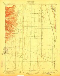
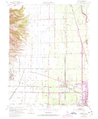
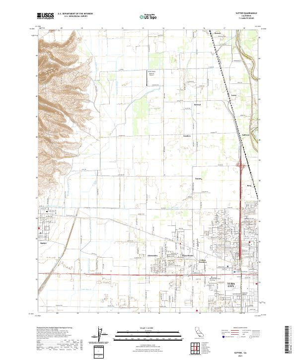
Sutter Buttes rise abruptly in the northwestern corner of this landscape, providing a stark topographical contrast to the surrounding agricultural plains of the Sacramento Valley. This region is defined by an intricate network of irrigation and drainage infrastructure, including the Wadsworth Canal, Sutter City Lateral, and Sutter County Extension Canal, which support the intensive farming around settlements like Sutter and Alemandra. The eastern edge of the map is dominated by the suburban expansion of Yuba City, where landmarks like the Sutter County Superior Courthouse and Cambridge Junior College are located. Smaller rural communities and junctions, such as Nuestro, Encinal, and Colusa Junction, are linked by a grid of farm-to-market roads and the path of the Feather River along the eastern boundary, illustrating the area's dual character as both a productive orchard and field-crop hub and a growing residential center.
Find a feature on this map
81 named features on this map. Tap any name to fly to it.
Don’t see what you’re looking for? This feature index may not catch every label — zoom into the map to look around manually.
Map Details
Editions of this 2021 Sutter Map
This is the sole edition of this map. No revisions or reprints were ever made.