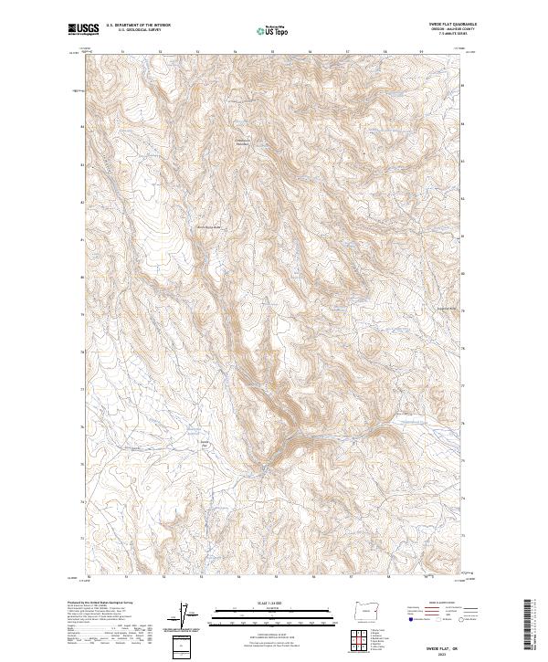
2023 Map of Swede Flat
USGS Topo · Published 2023About this map
Swede Flat is the central high-plateau feature of this southeastern Oregon landscape, defined by a series of remote springs and reservoirs that supported the region's livestock and rangeland history. This modern survey illustrates a network of water sources essential for navigation and survival in the high desert, from the Horse Camp Spring in the north to Alkali Spring in the south. The terrain is marked by prominent elevations like Cottonwood Mountain and the distinctive Burnt Stump Butte, which provide natural landmarks for those traversing the cattle country.
Find a feature on this map
38 named features on this map. Tap any name to fly to it.
Don’t see what you’re looking for? This feature index may not catch every label — zoom into the map to look around manually.
Map Details
Editions of this 2023 Swede Flat Map
This is the sole edition of this map. No revisions or reprints were ever made.
Other maps of this area

1906 · Mitchell Butte
USGS Topo · 1:125,000

1950 · Jamieson
USGS Topo · 1:62,500

1955 · Baker
USGS Topo · 1:250,000

1955 · Boise
USGS Topo · 1:250,000

1958 · Boise
USGS Topo · 1:250,000

1959 · Baker
USGS Topo · 1:250,000

1962 · Boise
USGS Topo · 1:250,000

1964 · Brogan
USGS Topo · 1:62,500

1966 · Harper
USGS Topo · 1:62,500
1967 · Vines Hill
USGS Topo · 1:24,000