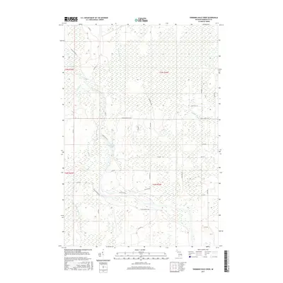
2017 Map of Swimming Hole Creek
USGS Topo · Published 2017About this map
The Escanaba River winds through the heart of this Upper Peninsula landscape, feeding into the prominent Boney Falls Basin. This 2017 study illustrates a region defined by its hydrography and a network of managed forest roads and lanes. Significant water features like Swimming Hole Creek, Leisner Cr, and Hunters Brook drain the surrounding wetlands, while names like Summer Meadow suggest the open clearings interspersed among the timber. The map details a unique local naming convention for transit, including the curiously titled Choo Choo B 75 and Co Rd Shopping Mall. These designations, alongside Town Hall F Ln and Plantation Rd, provide a modern record of the township's infrastructure and land use within the North American Datum of 1983 framework.
Find a feature on this map
33 named features on this map. Tap any name to fly to it.
Don’t see what you’re looking for? This feature index may not catch every label — zoom into the map to look around manually.
Map Details
Editions of this 2017 Swimming Hole Creek Map
This is the sole edition of this map. No revisions or reprints were ever made.
Other maps of this area

1932 · Rock SW
USGS Topo · 1:31,680

1932 · Helena NW
USGS Topo · 1:31,680

1932 · Helena NE
USGS Topo · 1:31,680

1932 · Whitney NE
USGS Topo · 1:31,680

1932 · Helena SW
USGS Topo · 1:31,680

1932 · Rock NW
USGS Topo · 1:31,680

1932 · Helena
USGS Topo · 1:31,680

1932 · Gladstone NW
USGS Topo · 1:31,680

1950 · Gladstone NW
USGS Topo · 1:31,680

1951 · Helena SW
USGS Topo · 1:31,680