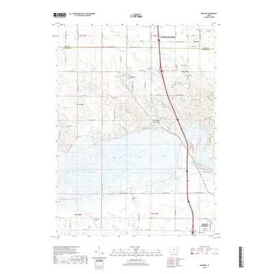
2018 Map of Swisher
USGS Topo · Published 2018About this map
The Iowa River meanders through the heart of this landscape, defining a corridor of wetlands and backwaters south of Swisher. This 2018 survey captures the interface of established rural communities and the southern expansion of Cedar Rapids along the corridor towards North Liberty. The topographic data highlights a region rich in family and local history, as evidenced by several smaller burial grounds such as Anderson Cem, Blain Cem, and Greencastle Cem. Aviation and recreation are central to the area's modern character, with the Green Castle Airport situated near the broad marshlands of Swan Lake and Twin Lake. The map details a well-connected grid of county roads, including Linn-Johnson Rd, which reflects the historical boundary between the two counties and the enduring importance of transit between settlements like Shueyville and Western.
Find a feature on this map
95 named features on this map. Tap any name to fly to it.
Don’t see what you’re looking for? This feature index may not catch every label — zoom into the map to look around manually.
Map Details
Editions of this 2018 Swisher Map
This is the sole edition of this map. No revisions or reprints were ever made.
Other maps of this area

1887 · Cedar Rapids
USGS Topo · 1:62,500

1888 · Amana
USGS Topo · 1:62,500

1889 · Amana
USGS Topo · 1:62,500

1891 · Oxford
USGS Topo · 1:62,500

1891 · Cedar Rapids
USGS Topo · 1:62,500

1891 · Iowa City
USGS Topo · 1:62,500

1894 · Oxford
USGS Topo · 1:62,500

1899 · Amana
USGS Topo · 1:62,500

1903 · Fairfax
USGS Topo · 1:125,000

1938 · Iowa City
USGS Topo · 1:62,500