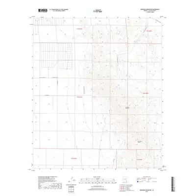
2018 Map of Swisshelm Mountain
USGS Topo · Published 2018About this map
The Swisshelm Mountains dominate this section of Cochise County, rising sharply above the desert floor and creating a complex landscape of drainages and peaks. To the southeast, the terrain is cut by the evocatively named Gila Monster Canyon, while the western flats are defined by the broad reach of Whitewater Draw. The road network here reveals a mix of rugged access and localized development, with routes like N Mountain Queen Rd and E Rucker Canyon Rd skirting the mountain base. In the western sections, a grid of private tracks and residential lanes such as N Princess Palace Way and N Washmore Ln suggests contemporary ranching or rural settlement patterns. This survey provides an essential view of the high-desert topography where the basin meets the range, documenting the modern road names and township boundaries within the T20S R27E and T20S R28E districts.
Find a feature on this map
16 named features on this map. Tap any name to fly to it.
Don’t see what you’re looking for? This feature index may not catch every label — zoom into the map to look around manually.
Map Details
Editions of this 2018 Swisshelm Mountain Map
This is the sole edition of this map. No revisions or reprints were ever made.
Other maps of this area

1916 · Pearce
USGS Topo · 1:125,000

1917 · Chiricahua
USGS Topo · 1:125,000

1919 · Chiricahua
USGS Topo · 1:125,000

1922 · Swisshelm
USGS Topo · 1:62,500

1926 · Light
USGS Topo · 1:62,500

1926 · Rucker
USGS Topo · 1:62,500

1926 · Pedregosa
USGS Topo · 1:62,500

1955 · Douglas
USGS Topo · 1:250,000

1958 · Chiricahua Peak
USGS Topo · 1:62,500

1958 · Squaretop Hills
USGS Topo · 1:62,500