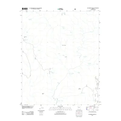
2012 Map of Sycamore Basin
USGS Topo · Published 2012About this map
Sycamore Basin dominates this landscape, where a sophisticated network of ephemeral water sources supported ranching and transit in the early 21st century. The terrain is defined by named uplands like Black Mountain and Packard Mesa, which overlook the winding course of Sycamore Cr and its tributaries such as Cedar Cr. A system of man-made and natural water features is distributed across the flats, including Indian Tank, Deadman Tank, and the notably located Henderson Tank near Henderson Flat. This density of named tanks, alongside vital water points like Parsons Spring and Summers Spring, reflects the critical importance of water management in this arid stretch of Yavapai County. Local landmarks like Cow Flat and the Black Mountain Tank provide specific points of reference for those tracing historical land use or geographical movement through the basin.
Find a feature on this map
25 named features on this map. Tap any name to fly to it.
Don’t see what you’re looking for? This feature index may not catch every label — zoom into the map to look around manually.
Map Details
Editions of this 2012 Sycamore Basin Map
This is the sole edition of this map. No revisions or reprints were ever made.
Other maps of this area

1886 · San Francisco Mtns
USGS Topo · 1:250,000

1886 · Chino
USGS Topo · 1:250,000

1887 · Verde
USGS Topo · 1:250,000

1887 · Prescott
USGS Topo · 1:250,000

1891 · San Francisco Mtns
USGS Topo · 1:250,000

1891 · Chino
USGS Topo · 1:250,000

1892 · Verde
USGS Topo · 1:250,000

1892 · Prescott
USGS Topo · 1:250,000

1894 · San Francisco Mtns
USGS Topo · 1:250,000

1899 · San Francisco Mtns
USGS Topo · 1:250,000