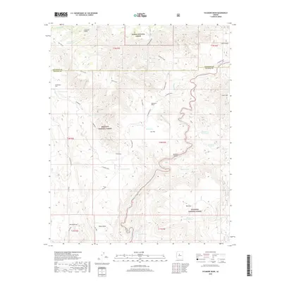
2018 Map of Sycamore Basin
USGS Topo · Published 2018About this map
Sycamore Canyon carves a deep path through this section of Arizona, where the boundaries of Kaibab National Forest, Prescott National Forest, and Coconino National Forest converge. The landscape is defined by its drainage network, with Sycamore Creek winding past prominent landforms such as Casner Mtn and Packard Mesa. For those tracing local history or land use, the map reveals a critical infrastructure of water management in an arid environment, noting numerous isolated water sources like Parsons Spring, Summers Spring, and Ocotillo Tank. The transition between Yavapai and Coconino counties is marked across high mesas and flats, including Henderson Flat and the depressions of Sycamore Basin. This survey provides a clear view of the complex topography and vital springs that have historically supported ranching and forestry in this high-desert region.
Find a feature on this map
33 named features on this map. Tap any name to fly to it.
Don’t see what you’re looking for? This feature index may not catch every label — zoom into the map to look around manually.
Map Details
Editions of this 2018 Sycamore Basin Map
This is the sole edition of this map. No revisions or reprints were ever made.
Other maps of this area

1886 · San Francisco Mtns
USGS Topo · 1:250,000

1886 · Chino
USGS Topo · 1:250,000

1887 · Verde
USGS Topo · 1:250,000

1887 · Prescott
USGS Topo · 1:250,000

1891 · San Francisco Mtns
USGS Topo · 1:250,000

1891 · Chino
USGS Topo · 1:250,000

1892 · Verde
USGS Topo · 1:250,000

1892 · Prescott
USGS Topo · 1:250,000

1894 · San Francisco Mtns
USGS Topo · 1:250,000

1899 · San Francisco Mtns
USGS Topo · 1:250,000