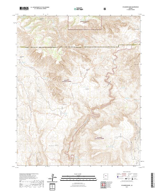
2021 Map of Sycamore Basin
USGS Topo · Published 2021About this map
Sycamore Creek carves a deep winding path through this corner of Arizona, where the boundaries of the Kaibab National Forest, Prescott National Forest, and Coconino National Forest converge. The landscape is defined by massive landforms like Packard Mesa and Casner Mtn, separated by the broad Sycamore Basin. Water sources are critical here, evidenced by numerous tanks and natural seeps such as Parsons Spring and Summers Spring. This 2021 survey shows a terrain dominated by wilderness management rather than settlement, with transportation limited to historic paths and service tracks like Henderson Trl and Railroad Draw. The intricate topography of Henderson Flat and Cow Flat illustrates the drainage patterns and elevation changes that have historically governed land use in this section of the Yavapai and Coconino county border.
Find a feature on this map
48 named features on this map. Tap any name to fly to it.
Don’t see what you’re looking for? This feature index may not catch every label — zoom into the map to look around manually.
Map Details
Editions of this 2021 Sycamore Basin Map
This is the sole edition of this map. No revisions or reprints were ever made.
Other maps of this area

1886 · San Francisco Mtns
USGS Topo · 1:250,000

1886 · Chino
USGS Topo · 1:250,000

1887 · Verde
USGS Topo · 1:250,000

1887 · Prescott
USGS Topo · 1:250,000

1891 · San Francisco Mtns
USGS Topo · 1:250,000

1891 · Chino
USGS Topo · 1:250,000

1892 · Verde
USGS Topo · 1:250,000

1892 · Prescott
USGS Topo · 1:250,000

1894 · San Francisco Mtns
USGS Topo · 1:250,000

1899 · San Francisco Mtns
USGS Topo · 1:250,000