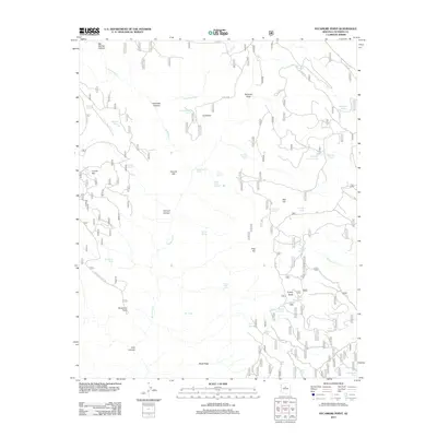
2012 Map of Sycamore Point
USGS Topo · Published 2012About this map
Sycamore Point overlooks a complex network of high-desert drainage systems and springs within Coconino County. The landscape is defined by deep incisions like Volunteer Canyon and Tule Canyon, which feed into the primary course of Sycamore Cr. This 2012 survey illustrates a region where water management is critical, evidenced by numerous named tanks such as Mooney Tank and Turkey Tank distributed across the plateau to support livestock or wildlife. Human presence is largely marked by an intricate web of Forest Service roads, including Sycamore Point Rd and Jerome Rd, providing access to remote landmarks like Turkey Butte and Buck Ridge. The names of local water sources, such as Geronimo Spring, Babes Hole Spring, and Winter Cabin Spring, suggest a history of seasonal use and exploration in this arid reach of the Arizona highlands.
Find a feature on this map
54 named features on this map. Tap any name to fly to it.
Don’t see what you’re looking for? This feature index may not catch every label — zoom into the map to look around manually.
Map Details
Editions of this 2012 Sycamore Point Map
This is the sole edition of this map. No revisions or reprints were ever made.
Other maps of this area

1886 · San Francisco Mtns
USGS Topo · 1:250,000

1886 · Chino
USGS Topo · 1:250,000

1887 · Verde
USGS Topo · 1:250,000

1887 · Prescott
USGS Topo · 1:250,000

1891 · San Francisco Mtns
USGS Topo · 1:250,000

1891 · Chino
USGS Topo · 1:250,000

1892 · Verde
USGS Topo · 1:250,000

1892 · Prescott
USGS Topo · 1:250,000

1894 · San Francisco Mtns
USGS Topo · 1:250,000

1899 · San Francisco Mtns
USGS Topo · 1:250,000