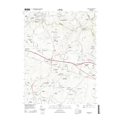
2014 Map of Sykesville
USGS Topo · Published 2014About this map
The South Branch Patapsco River and its numerous tributaries define the landscape of this Maryland corridor as it appeared in the early 21st century. The map illustrates a densely settled region transitioning between Sykesville and Eldersburg, where historic centers like Marriottsville and Woodstock are surrounded by modern residential estates such as Patapsco Estates and River Park Estates.
Find a feature on this map
216 named features on this map. Tap any name to fly to it.
Don’t see what you’re looking for? This feature index may not catch every label — zoom into the map to look around manually.
Map Details
Editions of this 2014 Sykesville Map
This is the sole edition of this map. No revisions or reprints were ever made.
Other maps of this area

1892 · Laurel
USGS Topo · 1:62,500

1892 · Ellicott
USGS Topo · 1:62,500

1893 · Frederick
USGS Topo · 1:125,000

1894 · Ellicott
USGS Topo · 1:62,500

1894 · Laurel
USGS Topo · 1:62,500

1894 · Frederick
USGS Topo · 1:125,000

1897 · Laurel
USGS Topo · 1:62,500

1906 · Ellicott
USGS Topo · 1:62,500

1907 · Laurel
USGS Topo · 1:62,500

1908 · Patapsco
USGS Topo · 1:125,000