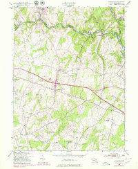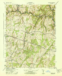
1944 Map of Sykesville
USGS Topo · Published 1944About this map
The South Branch Patapsco River carves a deep, winding valley through the northern portion of this landscape, serving as the physical boundary between Carroll and Howard counties. Along its banks, the Baltimore and Ohio Railroad connects early industrial and rural outposts like Sykesville, Gaither, and Marriottsville. The interior is defined by a network of upland ridges and creek valleys, where small settlements such as Alpha, Mountview, and West Friendship are anchored by local spiritual and community centers like St James Church and the Mountain View Cemetery.
Find a feature on this map
27 named features on this map. Tap any name to fly to it.
Don’t see what you’re looking for? This feature index may not catch every label — zoom into the map to look around manually.
Map Details
Editions of this 1944 Sykesville Map
This is the sole edition of this map. No revisions or reprints were ever made.
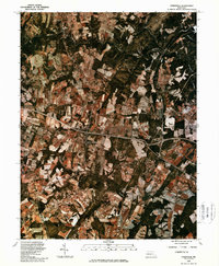
Historical Maps of Sykesville Through Time
8 maps found