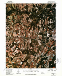
1981 Map of Sykesville
USGS Topo · Published 1986About this map
Sykesville sits at the northern edge of this 1981 orthophotograph, where the South Branch Patapsco River and North Branch Patapsco River converge. Unlike a traditional line-drawn topographic map, this infrared photo-imagery reveals the precise patchwork of active agricultural fields and expanding residential pockets during the early 1980s. The landscape is defined by its drainage patterns, with the Little Patuxent River and Middle Patuxent River cutting through the southern half of the quadrangle. West Friendship occupies a central position near the major road junction, showing the transition from rural crossroads to a more connected suburban corridor. Genealogists and local historians can use this aerial perspective to identify exact farmstead footprints and land-use changes near Woodstock before later decades of development further altered the rural character of Howard and Carroll counties.
Find a feature on this map
7 named features on this map. Tap any name to fly to it.
Don’t see what you’re looking for? This feature index may not catch every label — zoom into the map to look around manually.
Map Details
Editions of this 1981 Sykesville Map
This is the sole edition of this map. No revisions or reprints were ever made.
Other maps of this area

1892 · Laurel
USGS Topo · 1:62,500

1892 · Ellicott
USGS Topo · 1:62,500

1893 · Frederick
USGS Topo · 1:125,000

1894 · Ellicott
USGS Topo · 1:62,500

1894 · Laurel
USGS Topo · 1:62,500

1894 · Frederick
USGS Topo · 1:125,000

1897 · Laurel
USGS Topo · 1:62,500

1906 · Ellicott
USGS Topo · 1:62,500

1907 · Laurel
USGS Topo · 1:62,500

1908 · Patapsco
USGS Topo · 1:125,000