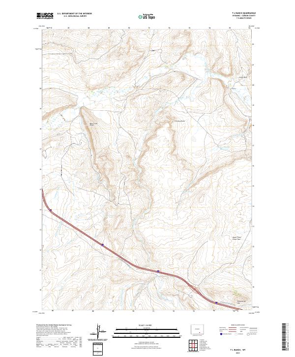
2021 Map of T L Ranch
USGS Topo · Published 2021About this map
Medicine Bow River meanders across the northern portion of this Carbon County landscape, defining a region characterized by ranching operations and high-altitude drainage systems. The T L Ranch serves as a primary human landmark in this area, situated near the distinctive geological formation of Castle Rock. The map illustrates a complex network of water management and natural hydrology, from the Tableland Ditch and Willow Springs Reservoir to the seasonal flows of Cherokee Gulch and W Fork Wagonhound Cr. Significant elevation changes are marked by Bear Creek Ridge and Chimney Rocks, while the southeastern corner is anchored by Sheepherder Hill. This 2021 survey documents the modern infrastructure of Elk Mountain Arlington Rd as it traverses the open expanse of Upper Foote Creek Flats, providing a clear view of the current land use and topography in this part of Wyoming.
Find a feature on this map
26 named features on this map. Tap any name to fly to it.
Don’t see what you’re looking for? This feature index may not catch every label — zoom into the map to look around manually.
Map Details
Editions of this 2021 T L Ranch Map
This is the sole edition of this map. No revisions or reprints were ever made.
Other maps of this area

1914 · Saddleback Hills
USGS Topo · 1:62,500

1915 · Como Ridge
USGS Topo · 1:48,000

1918 · Como Ridge
USGS Topo · 1:62,500

1921 · Saddleback Hills
USGS Topo · 1:62,500

1954 · Rawlins
USGS Topo · 1:250,000

1955 · Elk Mountain
USGS Topo · 1:24,000

1955 · Elk Mountain SW
USGS Topo · 1:24,000

1958 · Rawlins
USGS Topo · 1:250,000

1958 · White Rock Canyon
USGS Topo · 1:24,000

1958 · Arlington
USGS Topo · 1:24,000