
1954 Map of Rawlins
USGS Topo · Published 1968About this map
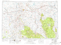
The Continental Divide zigzags through this high-altitude landscape of southern Wyoming, where the Union Pacific railroad corridor serves as the primary spine for industry and settlement. Industrial activity in the mid-1950s is concentrated near Rawlins, featuring the Utah Oil Refining Station, and the coal-producing area around Hanna. This survey provides a rare look at early transportation routes through the Great Divide Basin, marking the Overland Stage Station and the Overland Stage Monument as physical vestiges of westward migration. To the south and east, the map reveals the higher elevations of the Medicine Bow Mountains and Sierra Madre, punctuated by isolated outposts like the Sandstone Ranger Station and Larsen Headquarters Cabin. The drainage of the North Platte River into the Seminoe Reservoir anchors the northern region, while family-named sites like the Hadsell Winter Headquarters offer specific points of interest for genealogists tracing early ranching legacies.
Find a feature on this map
98 named features on this map. Tap any name to fly to it.
Don’t see what you’re looking for? This feature index may not catch every label — zoom into the map to look around manually.
Map Details
Editions of this 1954 Rawlins Map
2 editions found
Other maps of this area

1893 · Fort Steele
USGS Topo · 1:125,000

1895 · Laramie
USGS Topo · 1:125,000

1902 · Laramie
USGS Topo · 1:125,000

1905 · Laramie
USGS Topo · 1:125,000

1906 · Medicine Bow
USGS Topo · 1:125,000

1906 · Laramie
USGS Topo · 1:125,000

1908 · Laramie
USGS Topo · 1:125,000

1908 · Medicine Bow
USGS Topo · 1:125,000

1911 · Hahns Peak
USGS Topo · 1:125,000

1913 · Hahns Peak
USGS Topo · 1:125,000