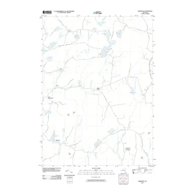
2010 Map of Taborton
USGS Topo · Published 2010About this map
Taborton and the surrounding highlands of Rensselaer County are defined by a dense network of upland lakes and glacial ponds in this 2010 survey. The landscape is dominated by water and wood, featuring notable bodies like Dyken Pond, Taconic Lake, and the source waters of the Poesten Kill. This area serves as a significant recreational and conservation corridor, illustrated by the presence of Camp Kiwanis and the large expanse of the Capital District Forest and Game Refuge in the southeast.
Find a feature on this map
67 named features on this map. Tap any name to fly to it.
Don’t see what you’re looking for? This feature index may not catch every label — zoom into the map to look around manually.
Map Details
Editions of this 2010 Taborton Map
This is the sole edition of this map. No revisions or reprints were ever made.
Other maps of this area

1888 · Berlin
USGS Topo · 1:62,500

1890 · Berlin
USGS Topo · 1:62,500

1893 · Cohoes
USGS Topo · 1:62,500

1893 · Troy
USGS Topo · 1:62,500

1894 · Berlin
USGS Topo · 1:62,500

1895 · Troy
USGS Topo · 1:62,500

1895 · Cohoes
USGS Topo · 1:62,500

1897 · Hoosick
USGS Topo · 1:62,500

1898 · Berlin
USGS Topo · 1:62,500

1898 · Cohoes
USGS Topo · 1:62,500