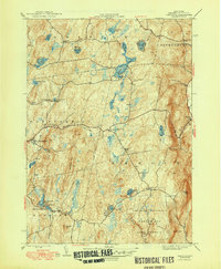
1948 Map of Taborton
USGS Topo · Published 1948About this map
The high plateau and glacial kettle ponds of eastern Rensselaer County dominate this post-war landscape. Small hamlets like East Poestenkill and Taborton are surrounded by an intricate network of water bodies, including Dyken Pond, Big Bowman Pond, and Little Bowman Pond. The map reveals the community infrastructure of the mid-1940s, marking local institutions such as School No 7, Toad Point Sch, and the Fifty Six Ch.
Find a feature on this map
40 named features on this map. Tap any name to fly to it.
Don’t see what you’re looking for? This feature index may not catch every label — zoom into the map to look around manually.
Map Details
Editions of this 1948 Taborton Map
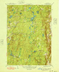
2 editions found
Other maps of this area

1888 · Berlin
USGS Topo · 1:62,500

1890 · Berlin
USGS Topo · 1:62,500

1893 · Cohoes
USGS Topo · 1:62,500

1893 · Troy
USGS Topo · 1:62,500

1894 · Berlin
USGS Topo · 1:62,500

1895 · Troy
USGS Topo · 1:62,500

1895 · Cohoes
USGS Topo · 1:62,500

1897 · Hoosick
USGS Topo · 1:62,500

1898 · Berlin
USGS Topo · 1:62,500

1898 · Cohoes
USGS Topo · 1:62,500