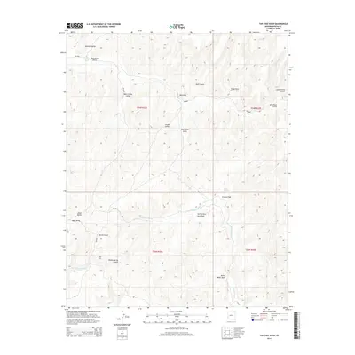
2014 Map of Tah Chee Wash
USGS Topo · Published 2014About this map
Tah Chee Wash and Oraibi Wash drain a high-desert landscape defined by intricate drainage networks and named landforms in this part of the Navajo Nation. The terrain is marked by significant topographical features such as Rain Mtn and the prominent Wind Rock. A complex system of Bureau of Indian Affairs (BIA) routes, including Bia-8066 and Bia-8018, provides access through several distinct valleys and canyons. Geologic and local history is visible through labels like Coal Spring and Sitting Giant Rock Wash, alongside seasonal watercourses such as Bitter Water Wash and Burnt Corn Wash. The map reflects a rural, indigenous landscape where place-names often describe the physical character of the earth or historical local landmarks like Black Stump Valley and Devils Canyon.
Find a feature on this map
31 named features on this map. Tap any name to fly to it.
Don’t see what you’re looking for? This feature index may not catch every label — zoom into the map to look around manually.
Map Details
Editions of this 2014 Tah Chee Wash Map
This is the sole edition of this map. No revisions or reprints were ever made.
Other maps of this area

1883 · Marsh Pass
USGS Topo · 1:250,000

1892 · Marsh Pass
USGS Topo · 1:250,000

1892 · Canyon De Chelly
USGS Topo · 1:250,000

1954 · Shiprock
USGS Topo · 1:250,000

1956 · Marble Canyon
USGS Topo · 1:250,000

1958 · Shiprock
USGS Topo · 1:250,000

1959 · Shiprock
USGS Topo · 1:250,000

1959 · Marble Canyon
USGS Topo · 1:250,000

1961 · Marble Canyon
USGS Topo · 1:250,000
1967 · Burnt Corn Spring
USGS Topo · 1:24,000